
Gloucestershire Maps
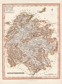
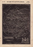
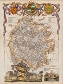
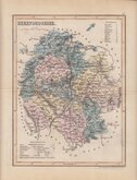
Herefordshire Maps
( Page 3 of 3 )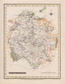
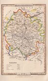
Roger Creighton 1831
Gray & Son 1833
Josua Archer 1833
Thomas Moule 1837 [1842]
James Pigot 1839
Joshua Archer 1842 [1858]
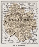
Geographia 1924


18x24 cm
FIRST ISSUE. FINE HAND COLOUR.
HEREFORDSHIRE
Drawn by R. Creighton | T.Starling Sculp. Whittington Square London.
DRAWN AND ENGRAVED FOR LEWIS' TOPOGRAPHICAL DICTIONARY.
The map was drawn by Roger Creighton (1796-1838) draughtsman and surveyor. Born at Tynemouth, he is first recorded as a land-surveyor in Wakefeld and perhaps trained under Christopher Greenwood with whom he worked on his series of county maps from 1818. He married Martha Gostling 16 Jan 1823 at St George Hanover Square and is variously recorded as draughtsman or surveyor on the baptismal records of their children between 1824 and 1834. He became the principal draughtsman for the Topographical Dictionary by Samuel Lewis. He was buried 9 April 1838 at St. Luke Chelsea.
Engraved by Thomas Starling, draughtsman, engraver, printer, bookseller and publisher, born 24 Dec 1796, son of Robert Starling and his wife Elizabeth Kearsley, and baptised at St. Mary Islington on 18th January 1797. Thomas had brothers in similar trades; Parlett Starling, printer, James Kearsley Starling, bookseller, and Matthew James Starling, engraver (mainly topographical views). Thomas was apprenticed (Stationers) in 1811. He married Ellen Smart at Mackworth, Derbyshire, 2nd November 1821. Declared bankrupt in 1824, he featured in a trial at The Old Bailey in 1828 when a canvasser, employed selling his plans of Islington, was prosecuted for embezzling the subscriptions. He was elected Fellow of the Royal Geographical Society on 23rd December 1833. Briefly imprisoned for debt in 1837, the 1841 Census describes him as an engraver living in Islington with his wife Ellen, schoolmistress, and three children. He died at Rochford, Essex, 15th June 1850.
Published by Samuel Lewis (1782-1865) in A Topographical Dictionary of England…Samuel Lewis and Co. from 1831. The work achieved considerable success and was re-issued many times by Lewis until 1849. During this time the maps were regularly updated to include parliamentary and electoral information and changes to the rapidly expanding railway network. Lewis later claimed that the work had taken six years to complete at a cost of £48,000.
Fine example from the first edition in neat hand colour.
Quick Links


Worcestershire Maps

Wales Maps
×