
Ordnance Survey Maps
Folding Maps
( Page 1 of 18 )
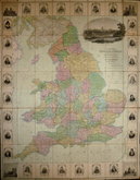
Bowles. England & Wales. 1811

Thomas Dix Derbyshire. 1818

Thomas Dix. Yorkshire. 1820

Hebner & Phillips. South East 1821

Henry Teesdale Yorkshire 1828
Robert Seaton. England & Wales 1838

Hobson's Yorkshire 1843

Stephen Glover 1845


106x136 cm
YORKSHIRE [WEST RIDING] SHEET CLXXXVI, 4.
CLXXXVI,12.
Surveyed in 1889
Published in 1890 Reprinted in 1893
Photozincographed and Published at the Ordnance Survey Office, Southampton,
Scale 1/2500 being 25.344 Inches to a Statute Mile or 208.33 Feet to One Inch.
Cover title: Ordnance Map. BURLEY HENRY GASKARTH, SUNBRIDGE BUILDINGS, BRADFORD. AGENT BY APPOINTMENT.
2 Sheets segmented into 32 sections 34x13cm, pasted on linen with burgundy cloth covers. Hand coloured to show ownership of areas by E.P.A-F, W.F & Co., Joint, Mrs Forster, W. Fison, F.W. Fison, W.H.Mitchell. (Stamp on front cover is E.P.A-F)
EWear at folds and one section parting. Ink stamp 'EX LIBRIS JSR' on front label and on several sections verso.
Quick Links

English Counties

Regional Maps
×