
English Counties
Folding Maps
( Page 1 of 18 )
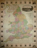
Bowles. England & Wales. 1811

Thomas Dix Derbyshire. 1818

Thomas Dix. Yorkshire. 1820

Hebner & Phillips. South East 1821

Henry Teesdale Yorkshire 1828
Robert Seaton. England & Wales 1838

Hobson's Yorkshire 1843

Stephen Glover 1845


£2 Bartholomew N. Yorkshire Coast
Ref: fm40
Add to
basket
Thanks,Your Product Has Been Added To Basket

86x57 cm
North Yorkshire Coast.
Cover title: PRICE ONE SHILLING AND SIXPENCE NET 7A | CARTOGRAPHERS BY APPOINTMENT TO THE KING | BARTHOLOMEW'S | REVISED "HALF-INCH" |COUNTOURED | MAPS | PUBLISHED AT THE EDINBURGH | GEOGRAPHICAL INSTITUTE BY | JOHN BARTHOLOMEW & SONS LTD. | ENGLAND SHEET 7A.| N. YORKSHIRE COAST.
Map title: BARTOLOMEW'S REVISED HALF INCH SERIES N.YORKSHIRE COAST ENGLAND AND WALES, SHEET 7A
Paper printed map pasted on linen in brown card book style covers.
Fair condition, a little worn and 'tired.
Quick Links

Ordnance Survey Maps

Regional Maps
×