
English Counties
Folding Maps
( Page 1 of 18 )
Bowles. England & Wales. 1811

Thomas Dix Derbyshire. 1818

Thomas Dix. Yorkshire. 1820

Hebner & Phillips. South East 1821

Henry Teesdale Yorkshire 1828
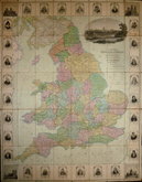
Robert Seaton. England & Wales 1838

Hobson's Yorkshire 1843

Stephen Glover 1845


60x48 cm
BACON'S MAP OF Hampshire
Scale 1 Inch = 3 Miles. Map divided into 5 mile Squares.
Paper map printed in 3 colours in card covers. Published by G.W.Bacon & Co., Ltd., Norwich Street Fetter Lane, E.C.4
Cover grubby and fraying at edges and spine. Map reasonably clean.
Quick Links

Regional Maps

Ordnance Survey Maps
×