
Ordnance Survey Maps
Folding Maps
( Page 6 of 17 )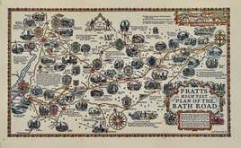
Alfred Taylor 1930
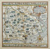
New Forest Alfred Taylor 1930
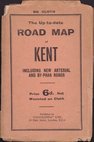
Geographia Kent 1932
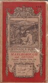
O.S. Marlborough Devizes 1932
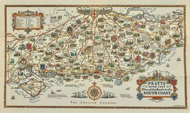
Alfred Taylor Pratts South Coast 1932
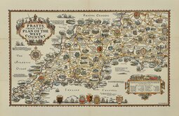
Alfred Taylor Pratts West Country 1932
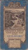
O.S. Guildford 1934
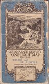
O.S. Truro St Austell 1934


86x59 cm
PEAK DISTRICT
BARTHOLOMEW'S REVISED HALF-INCH MAP
GREAT BRITAIN. SHEET 29
THE GEOGRAPHICAL INSTITUTE, EDINBURGH
COPYRIGHT-JOHN BARTHOLOMEW & SON. LTD.
Cloth backed.
Condition: Very poor. Splits with sellotape repairs to face of map.
Quick Links


English Counties

Regional Maps of England & Wales
×