
English Counties
Folding Maps
( Page 6 of 17 )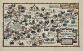
Alfred Taylor 1930
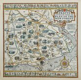
New Forest Alfred Taylor 1930
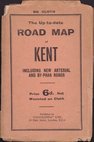
Geographia Kent 1932
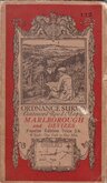
O.S. Marlborough Devizes 1932
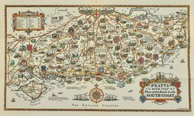
Alfred Taylor Pratts South Coast 1932
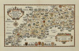
Alfred Taylor Pratts West Country 1932
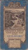
O.S. Guildford 1934
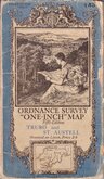
O.S. Truro St Austell 1934


67x53 cm
Cover title: 12 BARTHOLOMEW'S MAP OF ENGLAND AND WALES Scale: 2 Miles to an Inch. SHEET 12 LONDON: EDWARD STANFORD. 12, 13, & 14, LONG ACRE, W.C.
Map title: SHEET 12 BARTHOLOMEW'S "HALF-INCH TO MILE' MAP OF ENGLAND AND WALES. CHESHIRE.
Colour printed paper map segmented and pasted on linen. Paper Stanford covers. Owner's signature, date 24/6/04 and title to fromt cover. Close trimmed top & bottom as published. Good condition.
Quick Links


Regional Maps of England & Wales

Ordnance Survey Maps
×