
Asia
Far East & India
( Page 3 of 5 )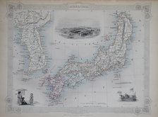
Japan & Korea - Tallis 1851
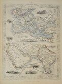
India Routes Tallis 1851
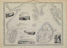
Indian Ocean Tallis 1851
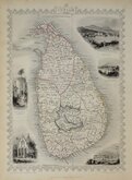
Ceylon Tallis 1851
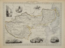
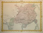
Tibet Mongolia Tallis 1851
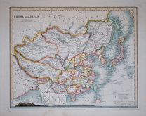
China & Japan by Petermann 1854
China & Myanmar - Tallis 1860
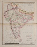
India by Petermann 1860


25x33 cm
OVERLAND ROUTE TO INDIA.
The Illustrations by H. Warren; & Engraved by J.H. Kernot. | The Map, Drawn & Engraved by J. Rapkin.
JOHN TALLIS & COMPANY, LONDON & NEW YORK.
Drawn and engraved on steel by J. Rapkin, this series of finely engraved maps were first published in parts from the end of the 1840's and issued as a complete volume, The Illustrated Atlas in 1851. The work was re-issued a number of times until about 1865 and the maps were then used by Montgomery Martin, the author of the text in the Illustrated Atlas, in his British Colonies from 1854. The final appearance of the maps, with vignettes erased from the plate, was in geographical dictionaries and encyclopaedias until about 1880.
This map of the overland routes to India is from the Illustrated Atlas of 1851. Originla hand colour and without centrefold. Vignettes of London Post Office, Gibraltar, Malta, The mail crossing the desert, Suex, Aden, Bombay, and Madras.
Light toning at page edges but with good margins, it remains a very good example from the first publication.
Includes original page of typeset text by Montgomery Martin.
Quick Links


Eastern Europe & Turkey

Historical Maps
×