
Ordnance Survey Maps
Estate and Building Plans
( Page 1 of 2 )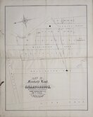
Snaresbrook Mornington Road 1884
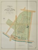
Amwell House Ware Herts 1899
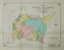
Woolmers Park Estate 1926
West Norwood & Stratford 1935
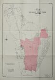
Swallow Grove Farm Hertford 1961
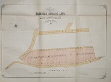
Musley Lane, Ware 1899
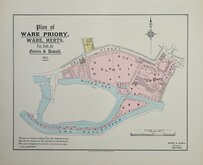
Ware Priory 1913
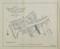
Hertford 1923


28x44 cm
Two plans:
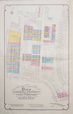
Plan of FREEHOLD PROPERTY SITUATE AT WEST NORWOOD.
To be Sold by Auction by, MESSRS. DRIVERS, JONAS & CO.
DRIVERS JONAS & CO., No.7, Charles Steet, St. James' Square S.W.1
1935.
COOK HAMMOND & KELL LTD. 47 & 49, TOTHILL ST. WESTMINSTER.
Plan of FREEHOLD PROPERTY SITUATE AT STRATFORD.
To be Sold by Auction by, MESSRS. DRIVERS, JONAS & CO.
DRIVERS JONAS & CO., No.7, Charles Steet, St. James' Square S.W.1
1935.
COOK HAMMOND & KELL LTD. 47 & 49, TOTHILL ST. WESTMINSTER.
Norwood Plan showing Hamilton Road, Carnac Street, Clive Road, Chalford Road, South Croxted Road,
Stratford Plan showing Albert Road (now Ash Road), Hatfield Road (now part Bramall Close), Idmiston Road, Chatsworth Road, Globe Road, Forest Lane
Both edge bound into Auction Sales Particulars. Some light handling creases but both maps clean and undamaged.
Price includes the complet sales document, for details see listing under Miscellany>Ephemera> Property Sales, Acts & Deeds.
Quick Links


Folding Maps

Country Houses
×