
Road Maps
Essex Maps
( Page 5 of 5 )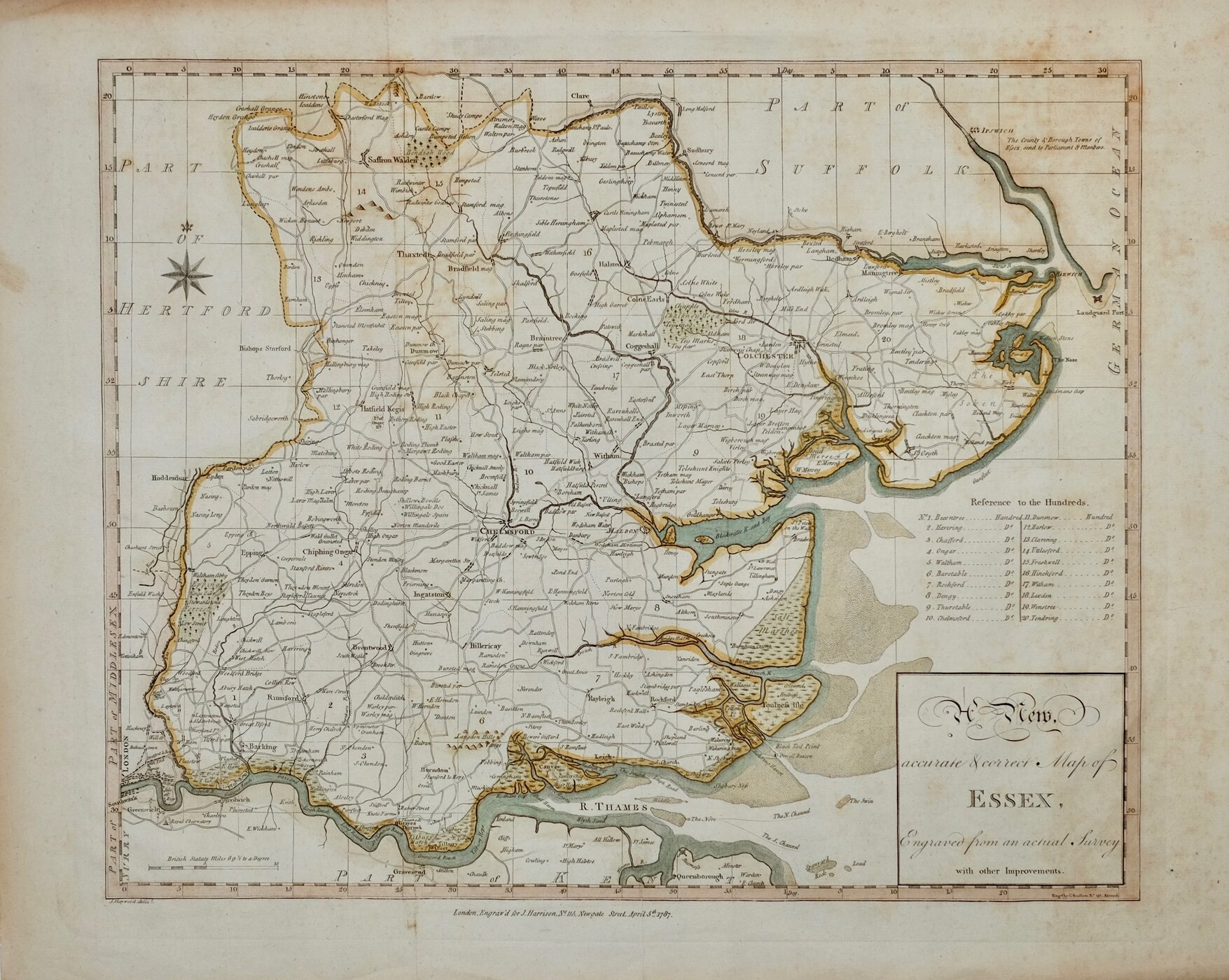

44x36 cm
CLEAR, NEATLY ENGRAVED FOLIO MAP.
A New, accurate & correct Map of ESSEX, Engraved from an actual Survey with other Improvements.
Engd. by E Sudlow, No.191, Strand.
J. Haywood Delt.
London, Engrav’d for J. Harrison. No.115 Newgate Street, April 5th. 1787.
Drawn by John Haywood and engraved by Edward Sudlow, this series of county maps were issued at erratic intervals over a four year period bearing dates between 1787 and 1789. The atlas Maps Of The English Counties… was first issued in 1791 by John Harrison and remained on sale for several years but appears to have not sold well as various reductions in price are recorded. Despite the claim in the title the maps were mostly based on the maps of Kitchin and Bowen published in The Large English, Royal and Anglicanus atlases. The border is divided and numbered at 5' intervals with a graticule over the map.
Neat hand colour. Folds as issued. Some light spotting.
Quick Links
Essex Prints
Hertfordshire Maps
×