
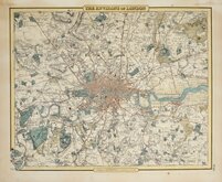
Central London
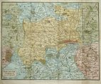
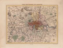
Environs of London
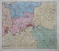
( Page 1 of 2 )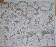
John Stockdale 1796
Thomas Tegg 1815 [c.1816]
John Russell 1818
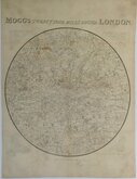
Edward Mogg 1832
William Hughes 1842
Cruchley Environs of London 1845
Joseph Hutchins Colton 1857
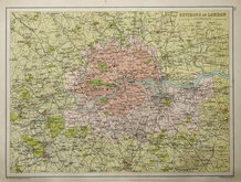
John Bartholomew 1892


40x35 cm
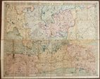
MAP OF THE COUNTRY SURROUNDING LONDON TO THE EXTENT OF THIRTY MILES.
Engraved for D.R HUGHSONS Description of LONDON, and Corrected to 1818.
Published by J. Robins & C.o Albion Press London.
Engraved by John Russell (1750-1829) for publication by James Stratford in London: being an accurate History and Description of the British Metropolis...by David Hughson...London 1805-1809.
Howgego ref. 246
This later edition, published by J. Robins, London 1818, is not listed in Howgego.
Folds as issued with a few short splits at folds in the margin not affecting the map repaired with archival tape. In very good condition in full original hand colour.
SPECIAL OFFER MOUNT OPTION AVAILABLE ON THIS ITEM AT CHECKOUT FOR UK CUSTOMERS.
Quick Links


Middlesex Maps
Ward Plans and Parts of London
×