
Mediterranean
Eastern Europe & Turkey
( Page 1 of 8 )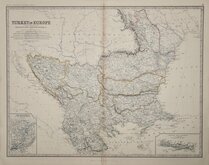
Turkey in Europe Johnston 1893
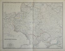
South West Russia Johnston 1861
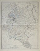
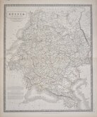
European Russia Johnston 1861
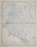
European Russia Johnston 1893
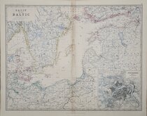
Baltic Johnston 1893
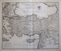
Asia Minor 1821
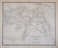
Turkey in Asia by Johnston 1843
Russia in Europe Johnston 1843

£30 North Germany Prussia Johnston
Ref: a6012.19
Add to
basket
Thanks,Your Product Has Been Added To Basket

58x47 cm
KEITH JOHNSTON'S GENERAL ATLAS.
NORTH GERMAN CONFEDERATION | BY KEITH JOHNSTON, F.R.S.E. | The Kingdom of PRUSSIA is Coloured Red.
William Blackwood & Sons, Edinburgh & London.
Engraved and Printed | by W.& A.K. Johnston, Edinburgh.
Lithographic printed map published in The Royal Atlas Of Modern Geography Exhibiting, in a series of entirely original and authentic maps, the present condition of geographical discovery and research in the several countries, empires, and states of the World by Alexander Keith Johnston geographer to the Queen for Scotland...William Blackwood & Sons Edinburgh and London MDCCCLXIX.
Showing Northern Germany and Prussia. Inset plan of the Environs of Berlin & Potsdam.
Overprinted in blue indicating rivers and sea and hand coloured in line and wash indicating political boundaries.
Two short closed tears and some light staining at paper edges not affecting the printed area. A large, finely engraved and detailed map.
Quick Links


Asia

Whole of Europe
×