
Yorkshire Maps
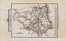
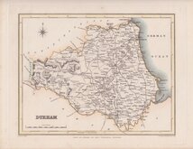
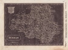
Durham Maps
( Page 3 of 4 )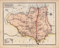
Samuel John Neele 1820 [c.1821]
George & John Cary 1822
Roger Creighton 1831
Selina Hall 1833
Sidney Hall 1833 [1852]
Robert Scott 1833 [c.1848]
Thomas Moule 1837 [c.1845]
Thomas Moule 1837 [c.1845]


42x35 cm
BRIGHT ORIGINAL HAND COLOUR
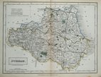
DURHAM.
London, Published by Teesdale & Co. 302 High Holborn.
Engraved, and probably also drawn, by Robert Rowe (c.1775-1843). The series were first issued as individual maps from 1812 and first published in The English Atlas ... by Robert Rowe, geographer. London 1816. Henry Teesdale acquired the maps and published them, with revised titles and his imprint, in his New British Atlas from 1829 until 1842. The life of the series was extended by publishers Henry George Collins and George Philip & Son publishing the maps by lithographic transfer in Atlases, Gazetteers and as loose maps from 1848 until about 1860 - a publication period of nearly 50 years. The life of some counties in the series was further extended in various local directories for several more years.
Very good clean example in bright original colour, intaglio printed and published by Henry Teesdale in 1830.
Quick Links

Durham Prints

Northumberland Maps
×