
Northumberland Maps
Durham Maps
( Page 1 of 4 )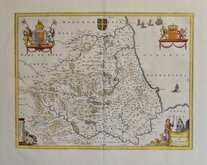
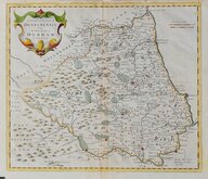
Jan Blaeu 1645 [c.1648]
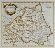
Richard Blome 1676
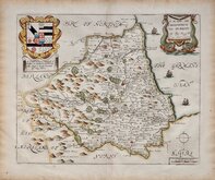
John Seller 1694 c.1784
John Seller 1694 [c.1784]
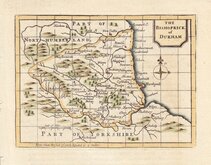
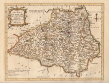
Robert Morden 1695 [1722]
Robert Morden 1695 [1753]
Owen & Bowen 1720
Thomas Kitchin 1763


16x14 cm
UNCOMMON.
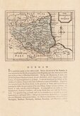
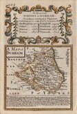
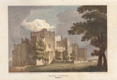
DURHAM
Neele & Son sc 352 Strand.
Published by G.& W.B.Whittaker, Ave-Maria Lane, 1821.
Copper engraving by Samuel John Neele & Son from The Travellers pocket atlas...by Pinnock and Maunder first published c.1820. The maps were re-issued under various tites published by Pinnock and Maunder or G & W B Whitaker, G Whittaker & Co. or George B Whittaker until 1825.
Samuel John Neele (1758-1824) was a prolific engraver working from Russell Court from 1781 and 352 Strand from 1785-1824. He traded with his younger brother George Neele as “S.& G. Neele” 1826-1824 and with his son James Neele as “Neele & Son” 1816-1824.
This very example of the county of Durham is in original hand colour. With the imprint of G.& W.B.Whittaker dated 1821, it is the second state of the plate published by G.& W.B.Whittaker in 1821 and 1823 and by G.Whittaker & Co. undated [c.1823].
SPECIAL OFFER MOUNT AVAILABLE AT CHECKOUT FOR UK POSTAGE
Quick Links


Yorkshire Maps
Durham Prints
×