
Yorkshire Maps
Durham Maps
( Page 1 of 4 )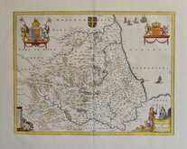
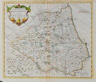
Jan Blaeu 1645 [c.1648]
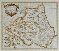
Richard Blome 1676
John Seller 1694 c.1784
John Seller 1694 [c.1784]
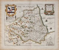
Robert Morden 1695 [1722]
Robert Morden 1695 [1753]
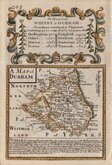
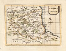
Owen & Bowen 1720
Thomas Kitchin 1763


25x20 cm
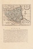
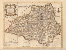
UPDATED RAILWAYS TO 1852
DURHAM.
ENGRAVED BY SID.Y HALL.
This series of maps first appeared in Gorton's Topographical Dictionary issued in parts over a three year period from 1830, the complete work not published again after 1833. The maps were then issued in A New British Atlas…, Sidney Hall's British Atlas…, A Travelling County Atlas… and other variations on the title, from 1834 until c.1888. It's popularity due in part to the continuous updating of the plates to include the latest railways. The maps were intaglio printed until c.1858 and then by lithographic transfer.
This example is from the 1852 edition entitled A Travelling County Atlas: with All the Railroads Accurately Laid Down and Coloured published by Chapman and Hall, 193 Piccadilly. (Late 186 Strand.)
Original hand colour. Some toning at centrefold.
Quick Links


Northumberland Maps
Durham Prints
×