
Northumberland Maps
Durham Maps
( Page 3 of 4 )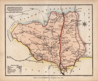
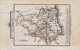
Samuel John Neele 1820 [c.1821]
George & John Cary 1822
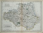
Roger Creighton 1831
Selina Hall 1833
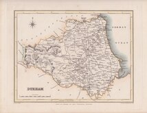
Sidney Hall 1833 [1852]
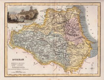
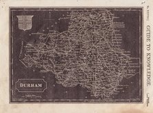
Robert Scott 1833 [c.1848]
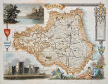
Thomas Moule 1837 [c.1845]
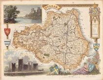
Thomas Moule 1837 [c.1845]


33x37 cm
FROM BLOME'S BRITANNIA
A MAPP OF YE: BISHOPRICK OF DURHAM.
By Ric: BLOME by his Matys. Comand.
Produced and published by Richard Blome, in Britannia: or, A Geographical Description of the Kingdoms of England, Scotland and Ireland...London, Printed by Tho. Rycroft for the undertaker, Richard Blome. 1673.
This series of maps were produced quickly, following an announcement in the press by John Ogilby of his intention to produce a new work of county maps, road maps and town plans entitled Britannia. Richard Blome shamelessly used the same title announced by John Ogilby for his work, and commenced publication in 1673. Blome’s maps are crudely engraved, typical of journeyman work, and mostly copied from those of John Speed, containing no new information. The printing, however, was of the highest standard, being carried out by Thomas Roycroft, printer to King Charles II.
Richard Blome (1635-1705), the son of bookseller Jacob Bloome and his wife Mary Adams, was baptised Richard Bloome, on 10th July 1635 at St Ann Blackfriars. In 1669 he was granted Royal Privilege by King Charles II giving him protection over his geographical books for twenty one years and later that year the king recommended the nobility and learned societies to subscribe to Blome’s work and requested that local justices, sheriffs, and mayors should offer him assistance. In 1673, when his Britannia was ready for the press, Blome petitioned the crown for a licence to publish a description of his Majesty’s dominions with maps and import 8,000 reams of royal paper duty free. He became Cosmographical Printer to King William III and Cosmographer to Queen Anne. Blome died in 1705 and was buried at Harlington, Middlesex, leaving his estate to Mrs Jane Hilton with whom he had lived many years, with bequests to the poor. His family disputed his will.
Britannia was probably on sale for four years. There was a re-issue of 1677 made up by John Wright from remaindered sheets.
Light toning to paper edges but with good margins the map is unaffected.
A very good example in fine hand colour.
SPECIAL OFFER MOUNT AVAILABLE AT CHECKOUT FOR UK POSTAGE
Quick Links

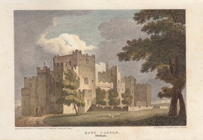
Durham Prints

Yorkshire Maps
×