
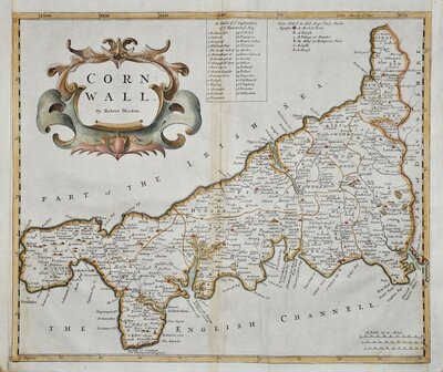
Cornwall Maps
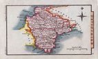
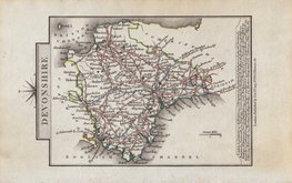
Devon Maps
( Page 1 of 2 )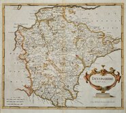
Robert Morden 1695
Owen & Bowen 1720
Thomas Kitchin 1750 [1769]
Henry Cooper 1808
Rowe Robert 1816 [1831]

William Pinnock 1819 [1823]
Sidney Hall 1820 [1834]
John Cary 1822


24x18 cm
ORIGINAL WASH COLOUR TO THE HUNDREDS
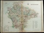
DEVONSHIRE
Drawn & Engraved by J.Archer, Pentonville, London.
First published in Curiosities of Great Britain, England and Wales Delineated…by Thomas Dugdale by L.Tallis in 1842. The work was re-issued a number of times until 1860. The maps also appeared in The Universal English Dictionary…by the Rev. James Barclay and finally in Tallis's topographical dictionary of England & Wales in 1860.
Joshua Archer (c.1792-1863) Engraver, cartographer and copperplate printer, was born in Barnstaple in Devon. His first recorded work as an engraver was a map of Scotland for Robert Wilkinson in 1814. He was declared bankrupt in 1835, imprisoned for debt in 1845, but on the 1861 census, he is recorded as a map and chart engraver aged 69, living in Islington with his wife Jane, a son, John, also a map and chart engraver, Albert Archer, map and chart draughtsman, Albert’s wife Elizabeth and their three children. His death was recorded at Islington in the final quarter of 1763.
Some occasional spotting to the paper, original wash colour from the 1858 edition of Dugdale's England and Wales Delineated.
Batten & Bennett Victorian Maps of Devon ref. 119.6
Quick Links

Somerset Maps

Dorset Maps
×