
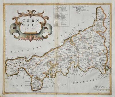
Cornwall Maps
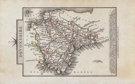
Devon Maps
( Page 1 of 2 )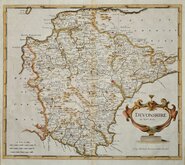
Robert Morden 1695

Owen & Bowen 1720
Thomas Kitchin 1750 [1769]
Henry Cooper 1808
Rowe Robert 1816 [1831]

William Pinnock 1819 [1823]
Sidney Hall 1820 [1834]
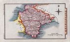
John Cary 1822


15x9 cm
CARY'S MINIATURE SERIES REVISED LAYOUT WITH TITLE AND IMPRINT ON THE SIDES.
DEVONSHIRE
London. Published by G. & J.Cary, No.86 St.James's Str.
A re-engraved and revised version of of the map issued by John Cary in 1806 which in turn, was a re-engraved version of his 1789 map. All were issued under the title of Cary's Traveller's Companion, a highly successful work necessitating the re-engraving of worn plates to continue publication. A fire at the premises in 1820 may have damaged or destroyed the plates requiring this new set of completely revised maps. The map was later published by Crutchley in his Railroad Companion of 1862 printed by lithographic transfer.
Previous editions of the Devon map were printed with North to the right but this edition has North to the top of the page with the title, list of towns and imprint sideways.
Good example in original hand colour published 1822-28.
Batten & Bennett Printed Maps of Devon ref.92.1
Quick Links

Somerset Maps

Dorset Maps
×