
Cornwall Maps
Devon Maps
( Page 2 of 2 )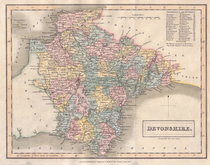
Sidney Hall 1830 [1831]
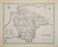
Roger Creighton 1831 [1845]
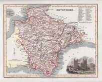
Robert Scott 1833 [1840]
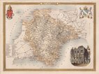
Thomas Moule 1837 [1842]
Joshua Archer 1842 [1858]
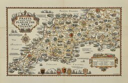
Alfred Taylor Pratts West Country 1932
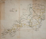
Railways Anonymous 1950
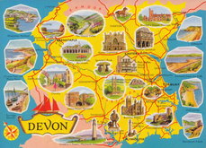
Devon Map Postcard 1970


42x34 cm
UNCOMMON EARLY ISSUE
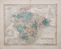
DEVONSHIRE
Engraved, and probably also drawn, by Robert Rowe, first published in The English Atlas ... by Robert Rowe, geographer. London Robert Rowe 1816, and sold as an individual map from 1812. Henry Teesdale acquired the maps and published them (intaglio printed) with revised titles and his imprint in his New British Atlas from 1829 until 1842. The life of the series was extended by publishers Henry George Collins and George Philip & Son until about 1860 - a publication period of nearly 50 years. Some counties in the series was further issued in various local directories for several more years.
This example of the map of Devon, with the addition of Rail Roads in the Key, is from the 1831 edition of Teesdale's New British Atlas.
Poor copy with a number of condition issues including centrefold split crudely repaired, Browning at cenrefold, no margins top and bottom and hole at Prawle Point. But is in good original hand colour and is a relatively uncommon map.
Ref. Batten & Bennet Printed Maps of Devon 81.4
Quick Links

Dorset Maps

Somerset Maps
×