
Sea Charts
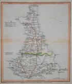
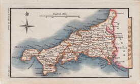
Cornwall Maps
( Page 1 of 3 )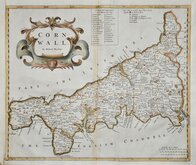
Robert Morden 1695
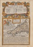
Emanuel Bowen 1720
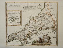
Thomas Kitchin 1749 [1769]
John Cary 1787 [1793]
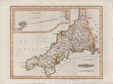
Benjamin Baker 1791
Robert Butters 1803
Nathaniel Coltman 1806 [1809]
Sidney Hall 1820 [1834]


23x17 cm
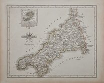
ARCHER/DUGDALE. OUTLINE HAND COLOUR.
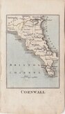
CORNWALL
Drawn & Engraved by J.Archer, Pentonville, London.
First published in Curiosities of Great Britain, England and Wales Delineated…by Thomas Dugdale by L.Tallis in 1842. The work was re-issued a number of times until 1860. The maps also appeared in The Universal English Dictionary…by the Rev. James Barclay and finally in Tallis's topographical dictionary of England & Wales in 1860.
This example is from the 1842 edition of Dugdales Curiosities in original hand colour. Stain at centrefold.
Quick Links

Devon Maps

England & Wales
×