
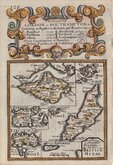
British Isles
Channel, Scilly and other small islands.
( Page 1 of 2 )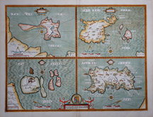
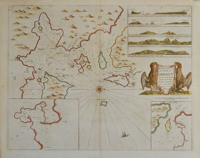
John Speed 1676
Emanuel Bowen 1720
Robert Morden. 1753
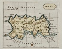
Jersey by John Seller 1787
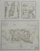
John Cary 1805

Jersey. Roger Creighton 1831
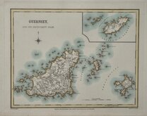
Guernsey. Roger Creighton 1831
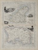
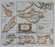
Channel Islands. John Tallis 1851

£40 Channel Islands John Tallis
Ref: 3169
Add to
basket
Thanks,Your Product Has Been Added To Basket

26x35 cm
CHANNEL ISLANDS.
The Map, Drawn & Engraved by J.Rapkin.
This series of detailed and decorative maps engraved by John Rapkin (1813-1899), were first published in parts from the end of the 1840's and issued as a complete work, The Illustrated Atlas, and Modern History of the World... in 1851. The work was published several times until about 1865, the maps were then used by Montgomery Martin, the author of the text for The Illustrated Atlas, in his British Colonies from 1854. The maps were later used with vignettes erased from the plate, in geographical dictionaries and encyclopaedia until about 1880.
Good example in fine later hand colour from the final issues without vignettes.
Folds as issued.
SPECIAL OFFER MOUNT OPTION AVAILABLE ON THIS ITEM AT CHECKOUT FOR UK CUSTOMERS.
Quick Links

Sea Charts
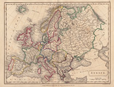
Europe
×