
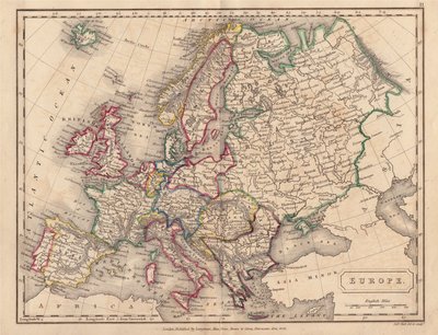
Europe
Channel, Scilly and other small islands.
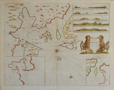
( Page 1 of 2 )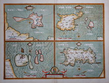
John Speed 1676
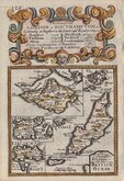
Emanuel Bowen 1720
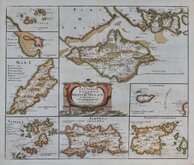
Robert Morden. 1753
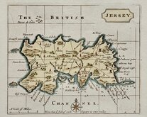
Jersey by John Seller 1787
John Cary 1805

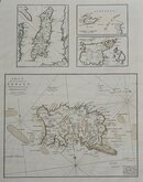
Jersey. Roger Creighton 1831
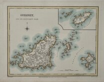
Guernsey. Roger Creighton 1831
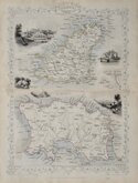
Channel Islands. John Tallis 1851


30x45 cm
THE CHANNEL ISLANDS
ALDERNEY
GUERNSEY AND SARK
JERSEY
LONDON, PUBLISHED BY CASSELL, PETTER & GALPIN. LA BELLE SAUVAGE YARD, LUDGATE HILL, E.C.
Lithograph printed map first published in The Weekly Dispatch between 1856 and 1862. The maps were also published as loose sheets and, when the series was complete, in The Dispatch Atlas from 1863. The publishers Cassell Petter and Galpin acquired the plates publishing them as loose sheets from 1864 and in Cassell's Illustrated family paper and Cassell's British Atlas in 1867. By 1869, the firm of G. W. Bacon had acquired the plates and published them in a number of titles for over forty years.
The map is unsigned, but other maps in the series were engraved by Edward Weller (1819-1884). John James Dower (1825-1901), or Benjamin Rees Davies (1789?-1872).
Some light additional creasing but still a good hand coloured example from the fourth lithographic transfer, with statistical information in typeset text transferred to the lithographic plate, published in Cassell's British Atlas...London Cassell, Petter & Galpin 1867.
Quick Links
Sea Charts

British Isles
×