
Cambridgeshire Prints
Cambridgeshire Maps
( Page 1 of 4 )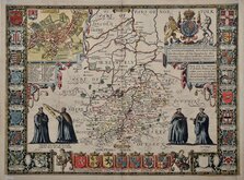
John Speed 1611
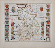
Jan Blaeu 1645
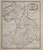
Robert Morden 1696 [1753]
Emanuel Bowen 1720
Thomas Read 1743 [1769]

Thomas Kitchin 1750 [1786]
George Bickham 1752
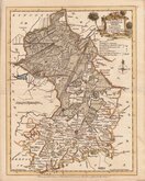
Joseph Ellis 1765


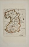
7x12 cm
COLOURFUL MINIATURE MAP.
CAMBRIDGESHIRE
Pub. by S.Leigh, 18. Strand. | Sid.y Hall sculp.t
Miniature map engraved by Sidney Hall and first published by Samuel Leigh in Leigh's New Pocket Atlas of England and Wales in 1820. The little atlas was popular running to ten editions, his widow, Mary Ann Leigh continuing publication after 1831 until the final editions in 1842 & 43 published by George Biggs and Orlando Hodgson.
Good hand coloured example from the first edition.
Quick Links

Town Plans

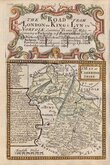
Road Maps
×