
Town Plans
Cambridgeshire Maps
( Page 1 of 4 )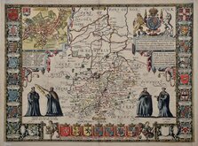
John Speed 1611
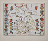
Jan Blaeu 1645
Robert Morden 1696 [1753]
Emanuel Bowen 1720
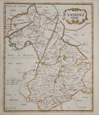
Thomas Read 1743 [1769]

Thomas Kitchin 1750 [1786]
George Bickham 1752
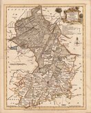
Joseph Ellis 1765


9x15 cm
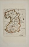
CARY'S MINIATURE SERIES.
CAMBRIDGESHIRE
London. Published by G.& J.Cary. No.86 St.James's Str.
A re-engraved and revised version of of the map issued by John Cary in 1806 which in turn, was a re-engraved version of his 1789 map. All were issued under the title of Cary's Traveller's Companion, a highly successful work necessitating the re-engraving of worn plates to continue publication. This issue, published with his brother George, between 1822 and 1835, was the only version with place names on the map engraved to read with North at the top, the title, imprint and distances from London being engraved sideways. The final issue was by lithographic transfer in Crutchleys' Railroad Companion to England and Wales...in 1862.
Some finger-marking. From the first state of the re-engraved plate of 1822 in original hand colour.
Quick Links

Cambridgeshire Prints

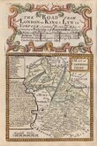
Road Maps
×