
Town Plans
Cambridgeshire Maps
( Page 1 of 4 )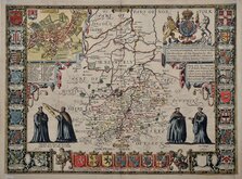
John Speed 1611
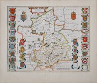
Jan Blaeu 1645
Robert Morden 1696 [1753]
Emanuel Bowen 1720
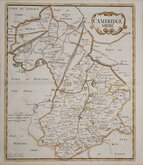
Thomas Read 1743 [1769]

Thomas Kitchin 1750 [1786]
George Bickham 1752
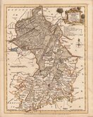
Joseph Ellis 1765


21x27 cm
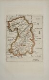
CAMBRIDGESHIRE
By JOHN CARY Engraver.
London: Publish'd Jan.y 1. 1793 by J.Cary Engraver & Map-seller, Strand.
Copper engraving by John Cary. This series of maps, commonly known as his "quarto" series, were published in Cary's New and Correct English Atlas and were justifiably popular, running to many editions from 1787 until about 1804. Re-engraved plates extended the life of the series from 1808 to 1843 and lithographic transfers from the plates by later publishers continued publication until about 1876 - a life of nearly 90 years.
From the 5th edition of 1793, this example has some creasing and is a little grubby but an original map in original hand colour.
Quick Links


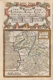
Road Maps
Cambridgeshire Prints
×