
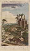
Cambridgeshire Prints
Cambridgeshire Maps
( Page 1 of 4 )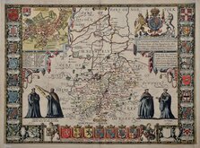
John Speed 1611
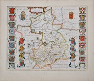
Jan Blaeu 1645
Robert Morden 1696 [1753]
Emanuel Bowen 1720
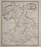
Thomas Read 1743 [1769]

Thomas Kitchin 1750 [1786]
George Bickham 1752
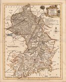
Joseph Ellis 1765


23x36 cm
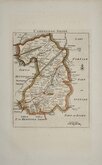
FROM LYSON'S MAGNA BRTIANNIA
CAMBRIDGESHIRE.
from a Trigonometrical Survey by Cha.s Mason D.D.
Neele Sculp. Strand.
Published May 1.st 1808 by Cadell & Davies.
Engraved by Samuel Neele (1758-1824) from a survey by Charles Mason and published in Lyson’s Magna Britannia. Being a concise topographical account of the several counties of Great Britain… Cadell & Davies 1808.
Horizontal folds. Hand coloured.
Quick Links

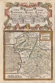
Road Maps

Town Plans
×