
Bedfordshire Maps
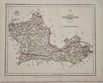
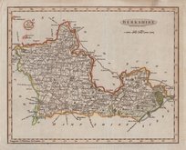
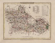
Berkshire Maps
( Page 2 of 4 )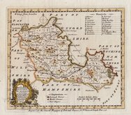
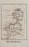
Emanuel Bowen 1758
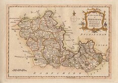
George Rollos 1762 [1769]
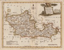
Joseph Ellis 1765 [1773]
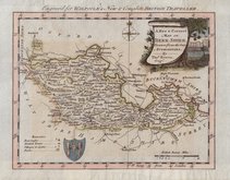
Thomas Bowen 1784
John Cary 1787 [1793]
Benjamin Baker 1791
Robert Butters 1803
George Cole 1804


20x18 cm
UNCOMMON.
BERKSHIRE Divided into its HUNDREDS - Containing - the Buroughs and Market Towns, with the Roads &c By Eman: Bowen Geog. to His Majesty.
Engraved for the General Magazine of Arts and Sciences for w. Owen at the Temple Bar 1758.
This small series were issued in The Natural History of England which formed part of The General Magazine of Arts and Sciences published from 1755 to 1764. Benjamin Martin (1704/5-1782), the author of the text accompanying the maps, started work as a plough-boy, became a teacher and took up writing, publishing books on many subjects including globes and the determination of longitude. He settled in Chichester about 1734 where he kept a school and became a notable maker of optical instruments but was bankrupted in 1781, attempted suicide and died the following year.
William Owen, the publisher of the work, was a well respected publisher and bookseller active from 1748 until his death in 1793. He was Master of the Stationers Company in 1781.
The engraver, Emanuel Bowen, worked in London from about 1720 to 1767 and was very prolific, engraving plates for Britannia Depicta , A Complete System of Geography, the London and Universal magazines, Harris' Complete Collection of Voyages, Universal History of the World and many of the maps in The Large English Atlas, The Royal English Atlas and Atlas Anglicanus. He was appointed engraver of Maps to George II and Louis XV.
The map of Berkshire was published in the magazine for March 1758.
The maps were not reissued again and are uncommon today.
Fine example in later hand colour.
Quick Links


Road Maps
Berkshire Prints
×