
Eastern Europe & Turkey
Asia
( Page 5 of 5 )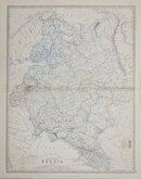
European Russia Johnston 1893
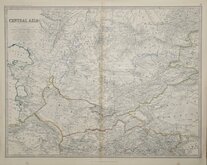
Central Asia Johnston 1893
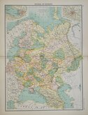
Russia in Europe Bartholomew 1898
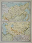
North & Central Asia Bartholomew 1898
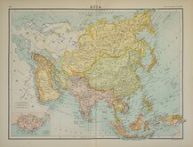
Asia Bartholomew 1898

£20 European Russia Johnston
Ref: 6012.26
Add to
basket
Thanks,Your Product Has Been Added To Basket

44x57 cm
EUROPEAN RUSSIA
BY KEITH JOHNSTON. F.R.S.E.
Engraved and Published by W.& A.K.Johnston, Edinburgh & London.
Lithographic printed map published in Keith Johnston's General Atlas under the full title:
The Royal Atlas Of Modern Geography Exhibiting, In A Series Of Entirely Original And Authentic Maps, The Present Condition Of Geographical Discovery And Research In The Several Countries, Empires, And States Of The World By The Late Alexander Keith Johnston ... With Additions And Corrections To The Present Date By T.B. Johnston ...W.& A.K. Johnston, Edinburgh and London, MDCCCXCIII.
Overprinted in blue indicating rivers and sea and hand coloured in line and wash indicating political boundaries.
Stain to centrefold.
Quick Links


Historical Maps
Far East & India
×