
Australasia & Pacific
Africa
( Page 1 of 9 )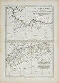
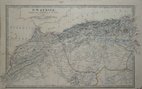
Morocco Algiers Tunis & Tripoli 1787
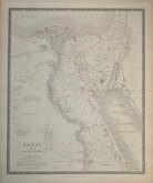
Egypt by Johnston 1843
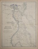
Egypt and Arabia by Johnston 1869
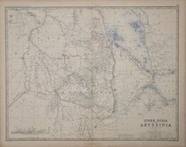
Ethiopia by Johnston 1869
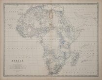
W & A K Johnston 1869
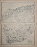
North West and South by Johnston 1869
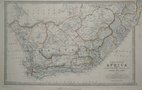
South Africa by Johnston 1893
North West Africa Johnston 1893

£15 Morocco Algiers Tunis & Tripoli
Ref: 2023gw
Add to
basket
Thanks,Your Product Has Been Added To Basket

24x35 cm
NORTH AFRICA
ETATS DU ROI DE MAROC; LES ROYAUMES D'ALGER, DE TUNIS ET DE TRIPOLI, AVEC LES PAYS CIRCONVOISINS,
Par M. BONNE, Ingénieur - Hydrographe de la Marine.
André sculp.
Published in Atlas Encyclopaedique... Rigobert Bonne & Nicolas Desmarest, Paris 1787.
Quick Links

South America
North America
×