
Africa
Australasia & Pacific
( Page 1 of 6 )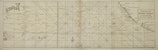
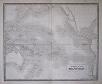
Pacific Ocean by Anson 1748
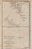
Vanuatu & New Caledonia Cook 1776
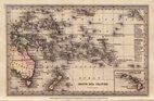
South Sea Islands by Starling 1831
Australasia by Pinnock 1834
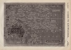
Pacific Islands by Johnston 1843
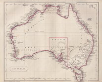
Australia by Becker 1850
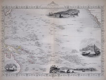
Polynesia by Tallis 1851
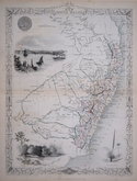
New South Wales by Tallis 1851


89x28 cm
A CHART of the PACIFIC OCEAN from the Equinoctial to the Latitude of 39½d. No.
R.W.Seale Sculp.
Chart engraved by Richard William Seale (1703-1762) on two sheets joined showing the voyage of Commodore Anson in The Centurion from Apapulco to Tenian and China and the voyages of the Spanish Galleon Nostra Seigniora de Cabadonga from Manila to Acapulco and from Apapulco to Guam and the Phillipines where she was taken by Commodore Anson in The Centurion on 30th June 1743.
The chart also shows the coastlines of The Philipines, Japan, Mexico and California.
Published in A Voyage Round The World, in the years MDCCXL,I,II,III,IV. by George Anson Esq...by Richard Walter, M.A. London 1748.
Some browing at sheet join but still a very good example,
Quick Links

Sea Charts
Far East & India
×