
Antiquarian
Atlases & Road Books
( Page 1 of 4 )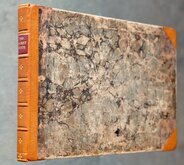
Gardner English Traveller
Wallis's Travellers Companion
Picture of England. Butters maps.
Ogilby Traveller's Guide 1712
Cox Magna Britannia Hertfordshire 1720
Magna Britannia Hertfordshire by Thomas Cox 1720
Senex Norden Speculum Middlesex & Hertfordshire 1723
Senex Norden Speculum Middlesex & Hertfordshire 1723


Request Condition Report
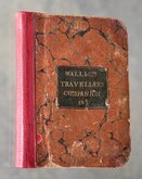
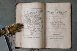
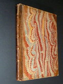
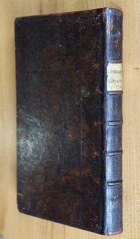
A New Pocket Atlas and Geography of England and Wales...By John Luffman Geogr. London. Printed for Lackington, Allen & C.o Temple of the Muses Finsbury Square. 1806.
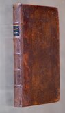
18mo. (10x16cm) Half red morroco, rebacked, pasted label to front board. Title. 2pp preface dated March 1803. Half title: England. 42 hand coloured engraved circular county maps above text description printed one side only. Half title: Wales. 12 hand coloured engraved circular county maps above text description printed one side only. Fold-out hand coloured map of England and Wales. Index.
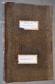
Original boards with label: LUFFMAN'S ATLAS & GEOGRAPHY OF ENGLAND AND WALES. Price 7/6 Plain, or 10/6 in Colors. Neatly rebacked . Owners manuscript signature to front endpaper; H Garvey (?) 1809. Complete but with some errors to text: Huntingdon map with text description of Lancashire below; Norfolk map with Middlesex text (see 3rd image); Warwickshire map with Westmorland text: Westmorland Map with Warwickshire text.Folding map with short split at fold intersection and trimmed with loss of right margin.
A very good clean example of an uncommon and unusual little atlas in neat hand colour.
Quick Links
General & Collectable
Map Books
×