
Antiquarian
Atlases & Road Books
( Page 1 of 4 )
Gardner English Traveller
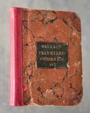
Wallis's Travellers Companion
Ogilby Traveller's Guide 1712
Cox Magna Britannia Hertfordshire 1720
Magna Britannia Hertfordshire by Thomas Cox 1720
Senex Norden Speculum Middlesex & Hertfordshire 1723
Senex Norden Speculum Middlesex & Hertfordshire 1723
Mostyn Armstrong Great Post-Roads 1783


Request Condition Report
PHILIPS' ATLAS OF THE COUNTIES OF ENGLAND, INCLUDING MAPS OF NORTH & SOUTH WALES, THE CHANNEL ISLANDS, AND THE ISLE OF MAP. NEW AND REVISED EDITION, WITH A COMPLETE CONSULTING INDEX.
GEORGE PHILIP & SON, LTD., LONDON: THE GEOGRAPHICAL INSTITUTE, 32 FLEET STRET, E.C. LIVERPOOL: PHILIP, SON & NEPHEW, 45 TO 51 SOUTH CASTLE STREET.
No date but 1885.
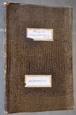
Folio (29x37cm) Modern green cloth rebind. Ex. library (The National Archives Historical Manuscripts Commission) With stamp to title page and margins of Hertfordshire (see second image) and Yorkshire South East.
49 double page (each map approx 42x34cm) lithograph printed maps by Edward Weller.
Maps with new guards. Repaired bottom centrefold split to several maps. Edge repair to Dorset not affecting printed map. Repaired 14cm tear to botttom edge Westmorland. Good margins left and right all maps except South Wales (trimmed close to printed border) but reduced margins top and bottom not affecting most maps but South sheet of Lancashire has title outside the map border and this partially lost. Generally all maps good clean condition on thick paper.
Quick Links
General & Collectable
Map Books
×