
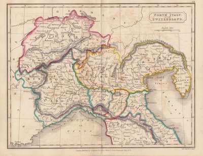
Italy
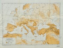
Whole of Europe
( Page 2 of 2 )

24x31 cm
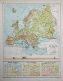
PHYSICAL MAP OF EUROPE
Coloured lithograph published in The English Imperial Atlas and Gazetteer of the World by J. G. Bartholomew, F.R.S.E., F.R.G.S. London. T. Nelson & Sons, Paternoster Row. Edinburgh and New York. (1892)
Section across Northern Europe along bottom margin. Inset charts of January and July Isotherms and Temperature range.
Crease right margin. Half map of Europe verso.
Quick Links
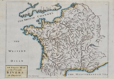
Whole of France
Germany
×