
Road Maps
Waterways & Railways
( Page 2 of 2 )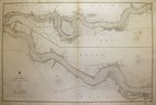
River Thames by Walker 1857
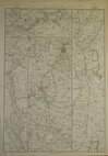
Great Western Railway by Weller 1863
Great Western Railway by Weller 1863
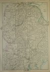
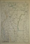
North Western Railway by Weller 1863
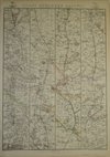
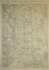
Great Northern Railway, Weller 1863
Great Northern Railway, Weller 1863
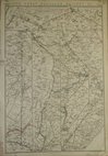
Eastern Counties Railway by Weller 1863
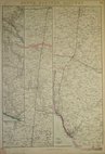
South Eastern Railway by Weller 1863


49x32 cm
RAILWAY MAP | OF | LONDON & SUBURBS | SHOWING | EACH COMPANY'S LINE | IN A SEPARATE CHARACTER. | SCALE - 1 INCH TO A MILE
2 colour Lithograph printed map of Rail and Underground Tube lines in London and suburbs by G W Bacon published in his Popular Atlas of the British Isles.
Extent: Alexandra Palace to Beckenham Junction & Hounslow to Barking.
Good condition.
Quick Links


London Maps

Town Plans
×