
Six inch and 1:10000
Twenty five inch and 1:2500
( Page 1 of 17 )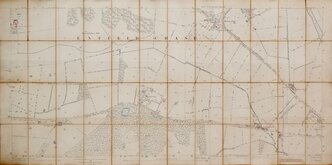
Enfield Chase 1885
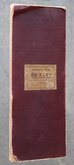
Burley Yorkshire 1:2500 1893
Bayfordbury Herts 1898
Gilston Herts 1898
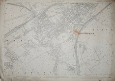
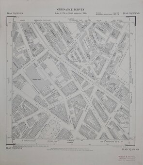
Totteridge Whetstone Herts 1898
Wyddial & Layston Land Exchange 1902
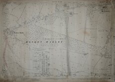
Pontefract Yorks 1907
Monken Hadley Herts 1914


£25
Ordnance Survey Ordnance Survey Ref: m6465
Add to
basket
Thanks,Your Product Has Been Added To Basket
Request
Condition Report
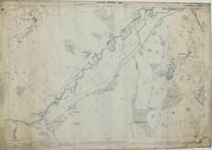
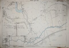
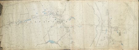
YORKSHIRE [WEST RIDING] SHEET CLXXXVI, 4.
CLXXXVI,12.
Surveyed in 1889
Published in 1890 Reprinted in 1893
Photozincographed and Published at the Ordnance Survey Office, Southampton,
Scale 1/2500 being 25.344 Inches to a Statute Mile or 208.33 Feet to One Inch.
Cover title: Ordnance Map. BURLEY HENRY GASKARTH, SUNBRIDGE BUILDINGS, BRADFORD. AGENT BY APPOINTMENT.
2 Sheets segmented into 32 sections 34x13cm, pasted on linen with burgundy cloth covers. Hand coloured to show ownership of areas by E.P.A-F, W.F & Co., Joint, Mrs Forster, W. Fison, F.W. Fison, W.H.Mitchell. (Stamp on front cover is E.P.A-F)
Wear at folds and one section parting. Ink stamp 'EX LIBRIS JSR' on front label and on several sections verso.
Quick Links

Fifty inch and 1:1250

Other Large Scales
×