

Whole of Britain & British Isles
Sale and Auction Catalogues
( Page 1 of 1 )
27th Antiquarian Book Fair.
Francis Edwards
John Speed Maps
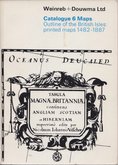
Weinreb & Douwma
Bloomsbury Important Books and Manuscripts NY2
Christies Scientific and Medical Instruments 1988
Sothebys Magnificent Books Lord Hesketh 2010

£12
Tony Campbell Weinreb & Douwma 1970 Ref: cat23
Add to
basket
Thanks,Your Product Has Been Added To Basket
Request
Condition Report
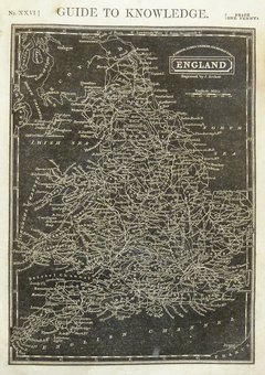
Weinreb & Douwma Ltd. Catalogue 6. Maps.
Outline of the British Isles: printed maps 1482 -1887.
Compiled by Tony Campbell. Issued 1970.
Paperback 15x21cm. 107 pages. b/w illustrations throughout.
A chronological catalogue of British isles maps with detailed descriptions and prices.
Good condition.
×