
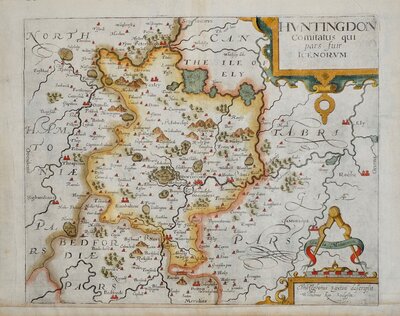
Huntingdonshire Maps
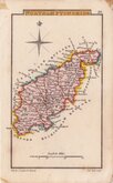
Northamptonshire Maps
( Page 2 of 3 )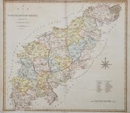
John Cary 1789 [1805]
John Cary 1793
Robert Butters 1803
George Cole 1807
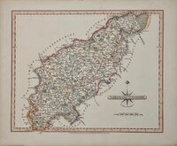
John Cary 1808 [1809]
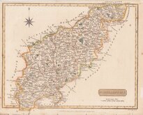
Samuel John Neele 1812
Sidney Hall 1820
John Cary 1822

£35
R Scott Archibald Fullarton Ref: 5398
Add to
basket
Thanks,Your Product Has Been Added To Basket

19x24 cm
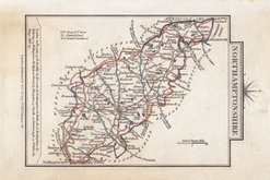
DECORATIVE MAP WITH VIGNETTE OF NORTHAMPTON
NORTHAMPTON SHIRE.
Pubd. by Archd. Fullarton & Co.
Steel engraving by Robert Scott first published in Bell's New and Comprehensive Gazetteer in 1833. The text for the gazetteer was largely copied from Lewis' Topographical Dictionary of 1831 and in 1839 Lewis obtained an injunction against Bell for plagiarism and the work was withdrawn. Archibald Fullarton, the publisher ofBell's Gazetteer republished the maps with new text in The Parliamentary Gazetteer from 1840 until 1849. The engraving work was shared between Gray & Son, James Neele and Robert Scott with most maps copied from those by Sidney Hall in an earlier topographical dictionary, John Gorton's Topographical Dictionary of Great Britain and Ireland published in 1831.
Robert Scott (1771-1841), born at Lanark 13 Nov 1771, the son of Robert Scott, a skinner and his wife Grizzell. He was apprenticed to Edinburgh engraver Alexander Robertson. He had premises in Edinburgh from 1797 to 1840, his Parliament Square premises occupied from 1810, were destroyed by fire in 1824. He died in January 1841 reputed to be the finest Scottish engraver of his time. Two of his sons, David Scott (1806-1849) and William Bell Scott (1811-1890) became notable artists.
This good hand coloured example of Northamptonshire, with the addition of the London & Birmingham Railway and erasure of the engraver's signature is from the 1845 edition of the Parliamentary Gazetteer.
Some spotting to margins.
Ref. Whitaker Printed Maps of Northumberland. 503.
Quick Links

Leicestershire Maps

Warwickshire Maps
×