
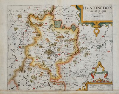
Huntingdonshire Maps
Northamptonshire Maps
( Page 1 of 3 )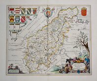
Jan Blaeu 1645 [1648]
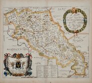
Richard Blome 1673
Robert Morden 1695
Emanuel Bowen 1720
Thomas Read 1744 [1769]
Thomas Kitchin 1763
Joseph Ellis 1765 [1773]
John Haywood 1788


7x12 cm
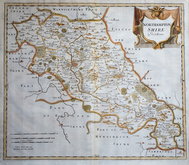
MINIATURE MAP
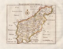
NORTHAMPTONSHIRE
Pub. by S.Leigh,18,Strand. | Sidy. Hall sculpt.
Engraved by Sidney Hall and first published in Leigh's New Pocket Atlas of England and Wales in 1820. The little atlas was popular running to ten editions until the final editions in 1842 & 3 published by George Biggs.
Old adhesive tape stains in each corner.
Fine hand colour. First edition.
Ref. Whitaker Printed Maps of Northamptonshire 356.
Quick Links

Warwickshire Maps

Leicestershire Maps
×