
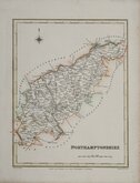
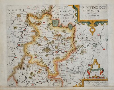
Huntingdonshire Maps
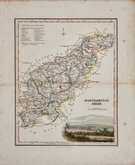
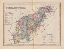
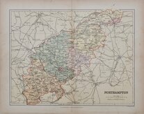
Northamptonshire Maps
( Page 3 of 3 )

25x20 cm
CLEAR, WELL ENGRAVED MAP. FIRST ISSUE.
NORTHAMPTON S.
Neele Sculpt. Strand
Published by James Cundee Albion Press London January 1.1812
This series of maps were engraved by Neele and probably sold singly from 1812 by James Cundee. J. Robins acquired the plates and published them in parts at Eight Shillings each from about 1818 in The New British Traveller; or Modern Panorama of England and Wales…By James Dugdale. The maps were re-issued in complete sets of the work in 1819 and 1820 and in Robins's atlas of England and Wales… and Dugdales New British Traveller...
Fine hand colour. First edition with imprint of James Cundee. Small margins top and left. Ragged maper edge to lower margin with some loss to wording of the map which extends well below the imprint.
Ref. Whitaker Printed Maps of Northamptonshire 326.
Quick Links

Warwickshire Maps

Leicestershire Maps
×