
Warwickshire Maps
Northamptonshire Maps
( Page 2 of 3 )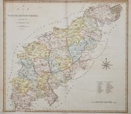
John Cary 1789 [1805]
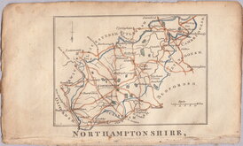
John Cary 1793
Robert Butters 1803
George Cole 1807
John Cary 1808 [1809]
Samuel John Neele 1812
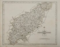
Sidney Hall 1820
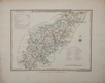
John Cary 1822

£45
Cole & Roper Vernor, Hood & Sharpe Ref: 4443gt
Add to
basket
Thanks,Your Product Has Been Added To Basket

23x18 cm
QUARTO MAP BY COLE & ROPER. Engraved by John Roper (1771-1810), a London engraver and copperplate printer trading from New Street Square from 1797 until his death in 1810. His widow, Mary Roper, continued the business at the same address until at least 1846. This series of maps, most drawn by G[eorge?] Cole, were intended to accompany The Beauties of England and Wales. The maps were not actually published with this work but first issued in parts as a separate series between 1804 and 1810 and first appearing in atlas form in The British Atlas published by Vernor Hood & Sharpe & nine other publishers in 1810. The maps were re-issued in several publications including Dugdale's Curiosities of Great Britain until 1843. Their final appearance was by lithographic transfer in Collins' railway and pedestrian atlas… published by Darton and Co. in 1858.
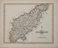
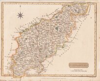
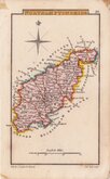
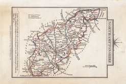
NORTHAMPTONSHIRE
Drawn and Engraved under the direction of E.W.Brayley.
Engraved by J. Roper, from a Drawing, by G. Cole | to accompany the Beauties of England & Wales.
London; Published for the Proprietors, by Vernor, Hood & Sharpe, Poultry, Sept.r 1.1807.
Good example in original hand colour in the first state of the plate published from 1807 to 1816. Good margins, clean and undamaged. Stitch holes to top edge suggesting early parts issue. Light diagonal crease outside printed area bottom right.
Ref. Whitaker Printed Maps of Northamptonshire 310.
Quick Links


Leicestershire Maps
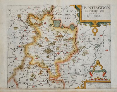
Huntingdonshire Maps
×