
Northamptonshire Maps
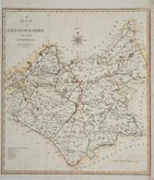
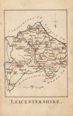
Leicestershire Maps
( Page 1 of 3 )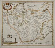
Robert Morden 1695 [1753]
Emanuel Bowen 1720
Joseph Ellis 1765 [1773]
John Haywood 1787 [1791]
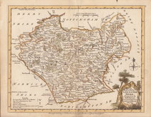
John Cary 1787 [1793]
John Cary 1789 [1805]
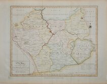
Robert Butters 1803
John Cary 1808 [1809]

£25
Cole & Roper Vernor, Hood & Sharpe Ref: 2631gh
Add to
basket
Thanks,Your Product Has Been Added To Basket

23x18 cm
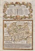
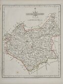
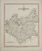
"COLE & ROPER"
LEICESTERSHIRE
Engraved by John Roper (1771-1810), a London engraver and copperplate printer trading from New Street Square from 1797 until his death in 1810. His widow, Mary Roper, continued the business at the same address until at least 1846. This series of maps, most drawn by George Cole, were intended to accompany The Beauties of England and Wales. The maps were not actually published with this work but first issued in parts as a separate series between 1804 and 1810 and first appearing in atlas form in The British Atlas published by Vernor Hood & Sharpe (& nine other publishers) in 1810. The maps were re-issued in several publications including Dugdale's Curiosities of Great Britain until 1843. Their final appearance was by lithographic transfer in Collins' railway and pedestrian atlas… published by Darton and Co. in 1858.
Good hand coloured example from the 1843 edition of Dugdales Curiosities.
Quick Links


Warwickshire Maps

Staffordshire Maps
×