
Northamptonshire Maps
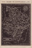
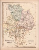
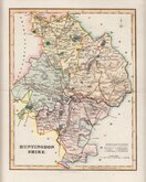
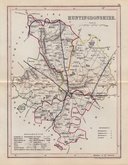
Huntingdonshire Maps
( Page 4 of 5 )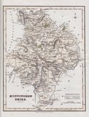
Robert Scott 1833
Joshua Archer 1833
Robert Scott 1833 [1840]
Robert Scott 1833 [c.1840]
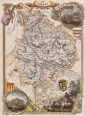
Sidney Hall 1833 [c.1852]
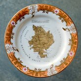
Coalport Map Plate 1835
Thomas Moule 1837 [1844]
Joshua Archer 1842 [1846]

Request
Condition Report
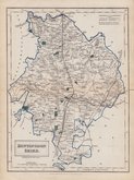
LARGE CLEAR MAP. NEAT HAND COLOUR.
A MAP OF HUNTINGDONSHIRE, ENGRAVED FROM AN ACTUAL SURVEY, with Improvements.
Haywood Del. | Sudlow Sc.
Engraved for J. Harrison, No.115, Newgate Street, as the Act directs, Sep.r 27.th 1788.
This series of county maps were issued at erratic intervals over a four year period bearing dates between 1787 and 1789. The atlas Maps Of The English Counties… was first issued in 1791 by John Harrison and remained on sale for several years but probably did not sell well as various price reductions are recorded.
The border is divided and numbered at 5' intervals with a graticule over the map set at 15o from the horizontal.
Printers creases top centre and right edge to Yaxley. Repair to bottom margin outside plate area. Good later hand colour.
Quick Links


Cambridgeshire Maps

Bedfordshire Maps
×