
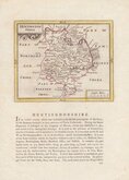
Northamptonshire Maps
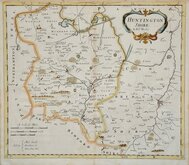
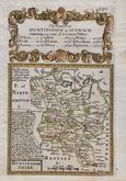
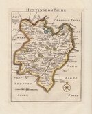
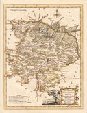
Huntingdonshire Maps
( Page 1 of 5 )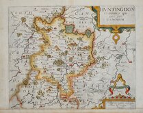
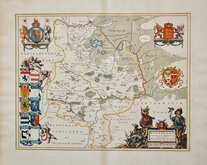
William Kip 1607 [1637]
Michael Drayton 1622
Jan Blaeu 1645
John Seller 1694 [c.1784]
Robert Morden 1695
Owen & Bowen 1720
Thomas Read 1744 [1769]
Thomas Kitchin 1763


17x23 cm
WOODBLOCK ENGRAVING
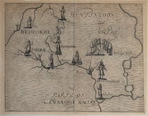
No. XLIV.} GUIDE TO KNOWLEDGE. PRICE ONE PENNY.
HUNTINGDON SHIRE
Published by Edwards Ave Maria Lane.
J.Archer sc. 100 Drummond Str. Euston Sq.
Woodblock engraved map by Joshua Archer. The woodblock was inked with a roller without working the ink into the engraved cuts thereby printing with a white line on a black ground. Published in parts by W. Edwards in The Guide to Knowledge edited by W Pinnock from 1833 The printing method was not popular for topographic maps and was not used again for English county maps. The woodblocks were later published by Thomas Johnson printed more conventionally by lithographic transfer in his rare publication Johnson's Atlas of England in 1847 & 1863.
Chipping and fraying to paper edges outside printed area and one small repair to top left corner.
Quick Links


Cambridgeshire Maps

Bedfordshire Maps
×