
Northamptonshire Maps
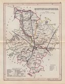
Huntingdonshire Maps
( Page 4 of 5 )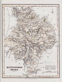
Robert Scott 1833
Joshua Archer 1833
Robert Scott 1833 [1840]
Robert Scott 1833 [c.1840]
Sidney Hall 1833 [c.1852]
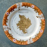
Coalport Map Plate 1835
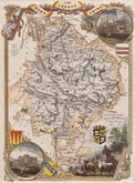
Thomas Moule 1837 [1844]
Joshua Archer 1842 [1846]


23x16 cm
FIRST EDITION.
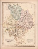
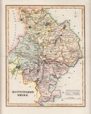
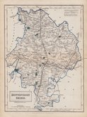
HUNTINGDONSHIRE
Drawn by R.Creighton. | T.Starling Sculp. Whittington Square London.
DRAWN AND ENGRAVED FOR LEWIS' TOPOGRAPHICAL DICTIONARY.
Copper engraving by Thomas Starling from a drawing by Roger Creighton issued in A Topographical dictionary of England… published by Samuel Lewis and Co. from 1831. The work achieved considerable success and was re-issued many times by Lewis until 1849. During this time the maps were amended and updated to include electoral information and the rapidly expanding railway network, with most counties known in at least six different states.
Good clean example from the first issue of 1831 in fine hand colour.
SPECIAL OFFER MOUNT OPTION AVAILABLE AT CHECKOUT FOR UK POSTAGE
Quick Links


Bedfordshire Maps

Cambridgeshire Maps
×