
Bedfordshire Maps
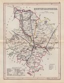
Huntingdonshire Maps
( Page 4 of 5 )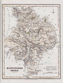
Robert Scott 1833
Joshua Archer 1833
Robert Scott 1833 [1840]
Robert Scott 1833 [c.1840]
Sidney Hall 1833 [c.1852]
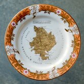
Coalport Map Plate 1835
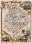
Thomas Moule 1837 [1844]
Joshua Archer 1842 [1846]


20x25 cm
FIRST STATE OF THE PLATE
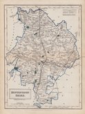
HUNTINGDON S.
Neele Sculpt. Strand.
Published by J.& J.Cundee. Albion Press. London. January 1, 1815.
Drawn and engraved by Samuel John Neele, this series were based on John Cary's 'quarto' maps of 1793. The early publication of this series is complex with loose issues and parts issues for many counties from about 1812. The first main publication containing the complete set of county maps was The New British Traveller; or, modern panorama of England and Wales...By James Dugdale... published about 1818 by J & J Cundee. The map appeared in three further issues under different titles in 1819 and 1820.
Good example in good hand colour in the first published state.
Quick Links


Northamptonshire Maps

Cambridgeshire Maps
×