
Hertfordshire Prints
Hertfordshire Maps
( Page 10 of 11 )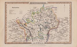
James Pigot & Isaac Slater 1839 [c.1841]
James Pigot & Isaac Slater 1839 [c.1841]
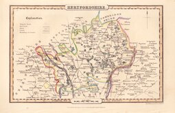
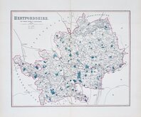
Joshua Archer 1842 [1860]
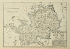
Benjamin Rees Davies 1860
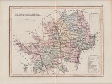
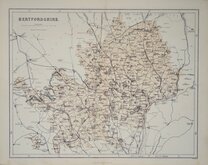
Edward Weller 1864 [1870]
Benjamin Rees Davies 1867
William Hughes 1868
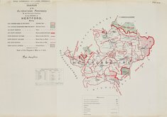
Boundaries Commission 1888

£15
Joseph Johson Joseph Johnson Ref: 4724gm
Add to
basket
Thanks,Your Product Has Been Added To Basket

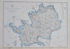
16x11 cm
SIMPLE MAP SHOWING RIVERS AND ONLY FIFTEEN TOWNS AND NO SCALE.
HERTFORDSHIRE
A simple outline map of the county showing only major towns and rivers with no border or scale.
The map was published by Joseph Johnson in England delineated; or a geographical description of every county in England and Wales...by John Aikin. from 1788. It had been assumed that the first edition of 1788 did not include maps but a copy with the full compliment of maps has been found (Carroll). There were five more editions from 1790 to 1809 containing maps, the final edition of 1818 did not includes maps. The Hertfordshire map was unchanged in all editions except for re-touching to the lettering on the plate for the 5th and 6th editions.
This example is from the first state published from 1788 to 1800. The fine line joining the 'o' and 'c' in Baldock noted by Hodson is present but faint.
Ref. Hodson Printed Maps of Hertfordshire 54 (i)
Quick Links


Middlesex Maps

Essex Maps
×