
Essex Maps
Hertfordshire Maps
( Page 10 of 11 )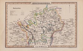
James Pigot & Isaac Slater 1839 [c.1841]
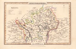
James Pigot & Isaac Slater 1839 [c.1841]
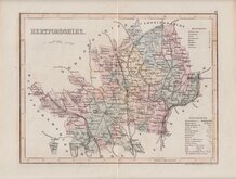
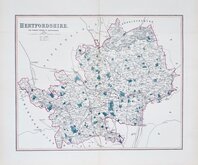
Joshua Archer 1842 [1860]
Benjamin Rees Davies 1860
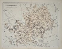
Edward Weller 1864 [1870]
Benjamin Rees Davies 1867
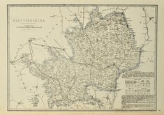
William Hughes 1868
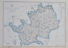
Boundaries Commission 1888


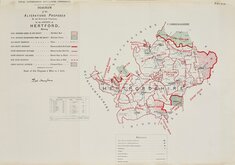
10x6 cm
UNCOMMON MINIATURE MAP LATER USED FOR THE "REUBEN RAMBLE" SERIES
HERTFORDSHIRE
London Published by R Miller, 24, Old Fish Street.
Miniature map first issued in sets of cards c.1819 by Thomas Crabb. They were also issued as a set of cards c.1822 by Hinton, by Darton also c.1822 and by Hodgson c.1825. All these playing card issues are extremely rare. This first atlas issue was published by Robert Miller in Miller’s new miniature atlas containing a complete set of county maps… London (1821). William Darton acquired the plates, publishing them in Darton’s new miniature atlas containing a complete set of county maps… London (1822) & (1825). The maps are best known, printed by lithographic transfer with the addition of vignettes of local landmarks and industry, published in Rev. Samuel Clark’s Georgian school atlas Reuben Ramble's Travels Through the Counties Of England in 1845 & 1850.
This example is from the first atlas issue of 1821 published by Robert Miller.
Uncommon.
Ref. Hodson Printed Maps of Hertfordshire 81 (i)
Quick Links


Hertfordshire Prints

Middlesex Maps
×