
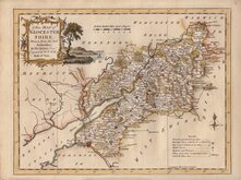
Somerset Maps
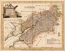
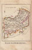
Gloucestershire Maps
( Page 1 of 3 )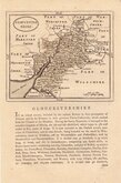
John Seller 1693 [c.1784]
Robert Morden 1695
Emanuel Bowen 1720
Thomas Kitchin 1751 [c.1786]
Thomas Kitchin 1763
Joseph Ellis 1765 [1773]
Robert Butters 1803
Neele Samuel 1805


18x24 cm
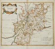
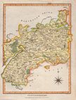
ORIGINAL WASH HAND COLOUR TO THE HUNDREDS.
GLOUCESTERSHIRE
Drawn & Engraved by J. Archer, Pentonville, London.
First published in Curiosities of Great Britain, England and Wales Delineated…by Thomas Dugdale by L.Tallis in 1842. The work was re-issued a number of times until 1860. The maps also appeared in The Universal English Dictionary…by the Rev. James Barclay and finally in Tallis's topographical dictionary of England & Wales in 1860.
Joshua Archer (c.1792-1863), Engraver, cartographer and copperplate printer, born in Barnstaple in Devon. His first recorded work as an engraver was a map of Scotland for Robert Wilkinson in 1814. He was declared bankrupt in 1835, imprisoned for debt in 1845 but recorded as a map and chart engraver aged 69, on the 1861 census, living in Islington with his wife, Jane, a son, John, also a map and chart engraver, and Albert Archer, map and chart draughtsman, with his wife Elizabeth and three children.
Good example in wash hand colour from the 1858 edition of Dugdale's England and Wales Delinreated.
Quick Links


Wiltshire Maps
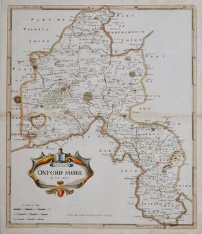
Oxfordshire Maps
×