
Eastern Europe & Turkey
Far East & India
( Page 3 of 5 )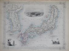
Japan & Korea - Tallis 1851
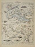
India Routes Tallis 1851
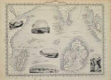
Indian Ocean Tallis 1851
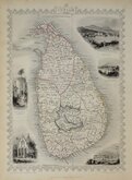
Ceylon Tallis 1851
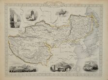
Tibet Mongolia Tallis 1851
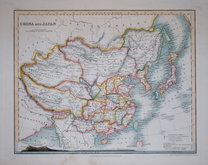
China & Japan by Petermann 1854
China & Myanmar - Tallis 1860
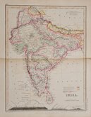
India by Petermann 1860


33x26 cm
ISLANDS IN THE INDIAN OCEAN
Map drawn and engraved by J. Rapkin. Vignettes of Madagascar, Ceylon, Port Louis, Mauritius, etc., Published in Tallis's Illustrated Atlas in 1851
Original outline colour. Centrefold.
Quick Links


Asia

Historical Maps
×