
Cambridgeshire Prints
Cambridgeshire Maps
( Page 2 of 4 )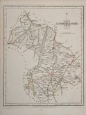
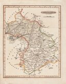
John Cary 1787 [1793]
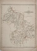
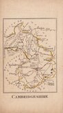
John Cary 1787 [1793]
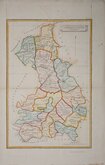
John Cary 1787 [1809]
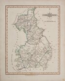
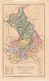
John Cary 1789 [1805]
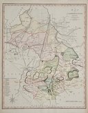
Benjamin Baker 1791
Robert Butters 1803
Charles Mason 1808
Henry Cooper 1808


19x26 cm
FIRST ISSUE. NEAT WASH COLOUR.
CAMBRIDGE SHIRE.
ENGRAVED BY SIDY. HALL
London, Published by Chapman & Hall, N.o186 Strand May 1830.
This series of maps first appeared in Gorton's Topographical Dictionary issued in parts over a three year period from 1830, the complete work not published again after 1833. The maps were then issued in A New British Atlas…, Sidney Hall's British Atlas…, A Travelling County Atlas… and other variations on the title, from 1834 until c.1888. It's popularity due in part to Hall's continuous updating of the plates to include the latest railways. The maps were intaglio printed until c.1858 followed by lithographic transfer until c.1888.
This example of the map of Cambridgeshire with the dated imprint of 1830, is the first published state issued in Gorton's topographical dictionary by Chapman and Hall in 1831 and 1833.
Horizontal folds as issued. Stains to left paper edge but with good margins not affecting map. Line and wash hand colour.
Quick Links

Road Maps

Town Plans
×