
Town Plans
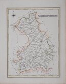
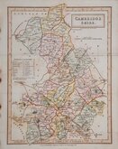
Cambridgeshire Maps
( Page 3 of 4 )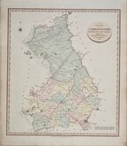
John Cary 1809
George Cole 1810
Samuel Neele 1819
Sidney Hall 1820
John Cary 1822
Aristide Perrot 1824
Roger Creighton 1831
Sidney Hall 1831


23x36 cm
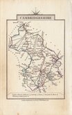
FROM LYSON'S MAGNA BRTIANNIA
CAMBRIDGESHIRE.
from a Trigonometrical Survey by Cha.s Mason D.D.
Neele Sculp. Strand.
Published May 1.st 1808 by Cadell & Davies.
Engraved by Samuel Neele (1758-1824) from a survey by Charles Mason and published in Lyson’s Magna Britannia. Being a concise topographical account of the several counties of Great Britain… Cadell & Davies 1808.
Horizontal folds. Hand coloured.
Quick Links

Cambridgeshire Prints

Road Maps
×